The coastal geomorphology and marine geology group in the BEADS lab are experts in fields ranging from coastal dune evolution and dynamics to coastal-nearshore sediment transport and dynamics. We also dabble in coastal dune and marine archaeology.
Research highlights include the development of surfzone-beachdune interaction models, the discovery of new dune types, the dynamics of mega-blowout dunes in Tibet and ‘sticky’ dunes on Titan, and the role of introduced fauna on coastal dune vegetation dynamics in Southern Australia.
Read about our current and past research projects, collaborative partners, latest publications and opportunities!
Current Research Projects and Initiatives
Coastal Modelling and Observations Program (COMOP)
Graziela Miot da Silva
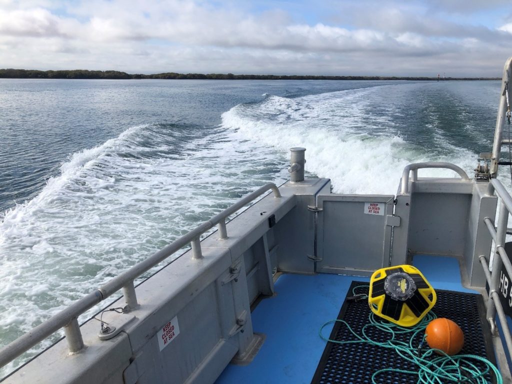
Oceanographic data (e.g. waves, currents) are critical to develop tools which are used to manage marine ecosystems and ultimately benefit industry, policy and management. Instrumentation to measure ocean data is one of the main requirements to drive the development of marine industries in Australia. These are the exact priorities that the Finders Coastal and Ocean Modelling and Observation Program (COMOP) is addressing, in partnership with the South Australian Research and Development Institute (SARDI), the Environmental Protection Authority (EPA) and SA Water, funded by the Department of Environment and Water (DEW). We have deployed and are currently maintaining three Spotter wave buoys in Gulf Saint Vincent to provide real-time wave data in Adelaide’s Metropolitan Coast. The data is available via www.sawaves.org.
For further information, please contact Dr Graziela Miot da Silva @ graziela.miotdasilva@flinders.edu.au.
Sediment Movement Dynamics Around Habitat Restoration Infrastructure to Improve Coastal Stabilisation
Ryan Baring & Graziela Miot da Silva
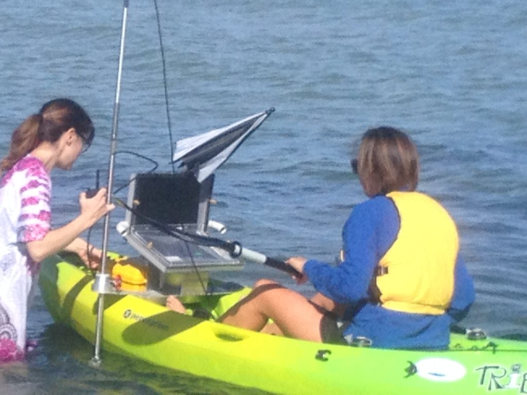
The project is being undertaken at the newly established Adelaide metropolitan shellfish reef site at Glenelg. Outcomes of the project and the validated sediment model produced could be used for design and management of further habitat restoration efforts in Gulf St Vincent with the ongoing roll-out of various restoration projects in the future. It will also provide great understanding of sediment movement dynamics along the metropolitan coastline and whether reef restoration can help ameliorate sand movement as a coastal defence mechanism in an area where sand drift is a continuing problem.
For further information, please contact Dr Graziela Miot da Silva @ graziela.miotdasilva@flinders.edu.au.
Assessment of Burn Severity with Optical & Radar Earth Observation Satellites
David Bruce & Marcio da Silva
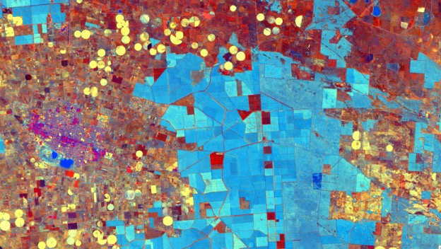
Use of satellite imagery from Sentinel 1 (C Band dual polarised SAR) and Sentinel 2 (optical blue to short wave Infrared) to measure burn severity. Case study following 2019/2020 Kangaroo Island wildfires utilising ground truth from airborne LiDAR, visible and near infrared aerial and drone imagery. The multi-temporal modified difference disturbance index derived from the Tasselled Cap Transform is being combined with the multi-temporal difference in cross and co polarised SAR to measure loss of biomass following fire.
For further information, please contact David Bruce @ david.bruce@flinders.edu.au.
Forest Disturbance with Earth Observation Satellites
David Bruce, Marcio da Silva & Dianne Patzel (UniSA)
As part of an FWPA project, Next Generation Resource Assessment and Forecasting for Australian Plantation Forestry, an example of a remote sensing application is being generated to illustrate how freely available satellite imagery can be used to detect forest disturbance (change) at regular intervals such as monthly or quarterly. The Forest Disturbance Index (FDI) investigation is showing some success at two broad sites (Southeast Queensland and Green Triangle in SA /Victoria), where disturbance could be detected at the forestry management unit (compartment) level. Current research is extending the tool to become spatio-temporal at the pixel level with further validation to proceed.
For further information, please contact David Bruce @ david.bruce@flinders.edu.au.
Fire Effects in Coastal Dunes on Kangaroo Island
Marcio da Silva
Following the January 2020 bushfires on Kangaroo Island, research was conducted on three dune sites. Repeat vegetation and drone surveys track the changes of the landscape as it recovers from the largest fire in recorded history. Remote sensing sources from space based and airborne sensors are used to describe the fire severity, landscape changes and vegetation succession. Field and space based studies are on-going.
Impacts of Rapid Shoreline Erosion Onto Coastal Dunes in the Coorong of South Australia
Marcio da Silva
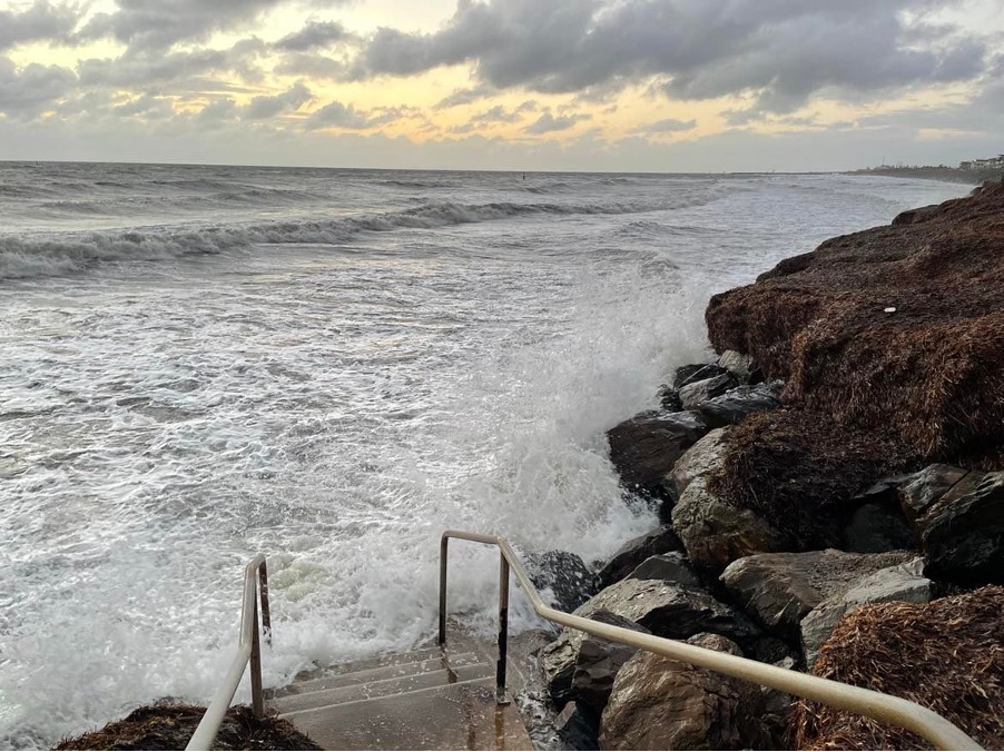
On-going shoreline erosion is driving rapid changes along the Younghusband Peninsula. This research is studying the morphodynamics responses of coastal dune systems to wave driven erosion and wind destabilisation. Remote sensing methods are used to measure the magnitude of changes, their rates of change and illustrate the rapid progression of coastal dunes translating inland.
For further information, please contact Marcio da Silva @ marcio.dasilva@flinders.edu.au.
40 years of Intertidal Beach Width on the Onkaparinga Coast
Michael Hillman (Research Project 2020)
An analysis of the South Australian Department of Environment and Water Beach Profile results from 1975 to 2018 for the Onkaparinga District Council jurisdiction in South Australia. Changes in the subaerial beach width (nominated as the zone between 0m AHD and the toe of the foredune) were identified through software developed in Python for the project. Calculated Beach Mobility Length and Area results show several locations are experiencing a trend of recession, but the majority are experiencing minimal change or accretion.
For further information, please contact Michael Hillman @ michael.hillman@flinders.edu.au.
Impacts of Shellfish Restoration Reef on Wave Attenuation in New Glenelg Shellfish Reef
Giorgia Bovari
Giorgia’s Master project investigated the potential effect of the new shellfish reef offshore of Glenelg (Adelaide) on wave energy dissipation, throughout the development of a Delft3D numerical model. A Delft3D FLOW module testing was simulated to highlight the influence of the Glenelg reef on tidal currents and bed shear stress. Furthermore, a Delft3D WAVE simulation was computed to analyse wave energy dissipation. The results showed a minimal ability of the reef to influence the hydrodynamics of the area, with most effects occurring during storm periods. The numerical model was subsequently validated by comparing the results with wave data collected by SA Water with a pressure sensor.
For further information, please contact Giorgia Bovari @ bova0005@flinders.edu.au
Geological Controls on Marine Driven Cliff Erosion
Michael Hillman (Honours Thesis 2021)
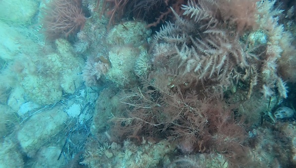
An examination of the role that rock mass characteristics (faults, joints, and fractures) play in the recession of the rock platform and cliffs at Blanche Point in South Australia. Analysis of 3D point clouds generated from photogrammetry and LiDAR surveys collected between 2015 and 2021 showed recession rates were between 3cm and 4cm per year. Compressive rock strength was measured with a Schmidt hammer, and the Hoeck and Brown Geological Strength Index was applied to categorise rock discontinuities throughout the intertidal zone. Wave energy dissipation at the beach / cliff interface was modelled using Delft3D and XBeach with areas of relatively higher wave energy showing a strong relationship to areas of material loss.
For further information, please contact Michael Hillman @ michael.hillman@flinders.edu.au.
How Sand Management & Events Along Adelaide Metro Coastline Influence Macroinvertebrate
Jasper Willoughby
This project investigates how sand management regimes and natural major sand movement events (e.g. storms) along the Adelaide metropolitan coastline influence macroinvertebrate communities. To determine the influence of sand management and natural sand movement upon macrofauna along the Adelaide metropolitan coastline, a series of seasonal surveys using core and sweep net samples, and beach morphological characteristics will be taken at various sites and tidal zones of the beach before, during, and after these events. The regular (e.g. seasonal) and extreme (e.g. storms) natural movement of sand along the coastline will also be modelled along with artificial movement from mechanical harvesters and sand pumping to determine potential future changes in beach morphology and its relationship with macrofauna. Results from the project will inform coastal managers of potential impacts and recovery times of sand nourishment programs on sandy beach ecology of nearshore macroinvertebrate communities.
For further information please contact Jasper Willoughby @ jasper.willoughby@flinders.edu.au.
Sediment Dynamics Associated with Shellfish Reef Restoration Program
Laura Thomas
The purpose of this project is to establish an understanding of how sediment settles and resuspends around habitat restoration structures such as a shellfish reef while identifying the interactions between the shellfish reefs and native seagrass beds at the new shellfish reef in Glenelg. The research will investigate how sediment settles and resuspends around a habitat restoration structure while developing hydrodynamic model to visually display the spatial movement in and around the reef. Analysis of grain size and organic matter content will be completed on sediment samples collected from the water column and seafloor. This project will provide baseline data for sediment dynamics around the habitat restoration infrastructure offshore Glenelg and new information about the functioning of a shellfish reef.
For further information, please contact Laura Thomas @ thom1327@flinders.edu.au.
Morphological Change Along Adelaide’s Beaches
Ben Perry
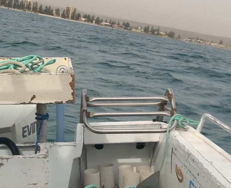
Collaborating with IHE Delft/Deltares and supported by the Department of Environment and Water, this study will model the long-term morphological change along Adelaide’s managed beaches (Seacliff to North Haven). The morphological modelling will be performed using ShorelineS which was developed but Roelvink et al. in 2018. The dominant driver of coastal change within the morphological model is waves so a detailed wave model of the Gulf St Vincent has been built using Delft3d-wave. The forecast model will then be built to inform future management strategies of the Adelaide coastline, particularly the feasibility of future sand nourishment regimes considering the effects of sea level rise.
For further information, please contact Ben Perry @ ben.perry@flinders.edu.au.
South Australian Dunefield Evolution
Patrick Hesp
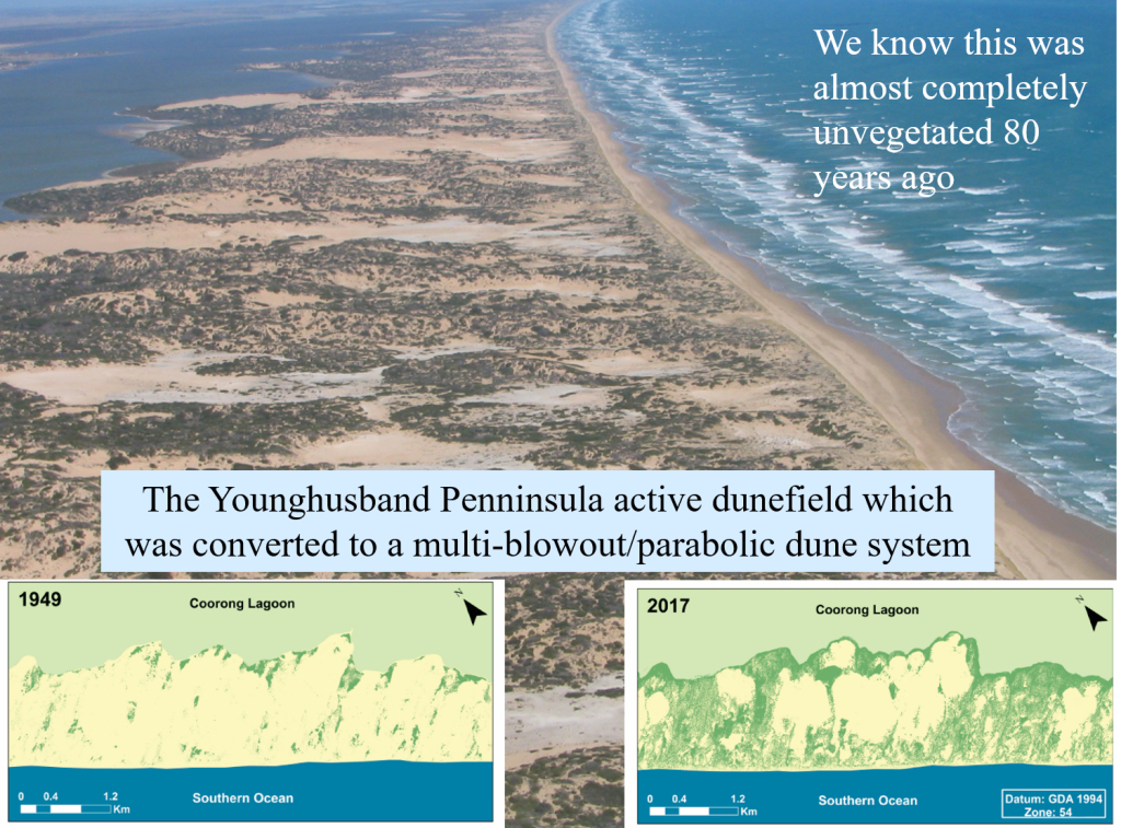
The evolution and geomorphology of coastal dunefields in Southern and Western Australia are poorly investigated. This research aims to better understand dunefield morphodynamics, and, in particular, how they are initiated, surfzone-beach-dune interactions, past and modern rates of sediment supply to dune systems, rates of dune transgression, and the relationships between vegetation colonisation processes and dunefield response.
For further information, please contact Professor Patrick Hesp @ patrick.hesp@flinders.edu.au.
Climate and environmental history of SE Queensland dunefields
ARC Funded research lead by James Shulmeister with Graziela Miot da Silva, Patrick Hesp, Talitha Santini, Daniel Ellerton, Tammy Rittenour and a host of others (see https://www.researchgate.net/project/Climate-and-environmental-history-of-SE-Queensland-dunefields#projectLog).
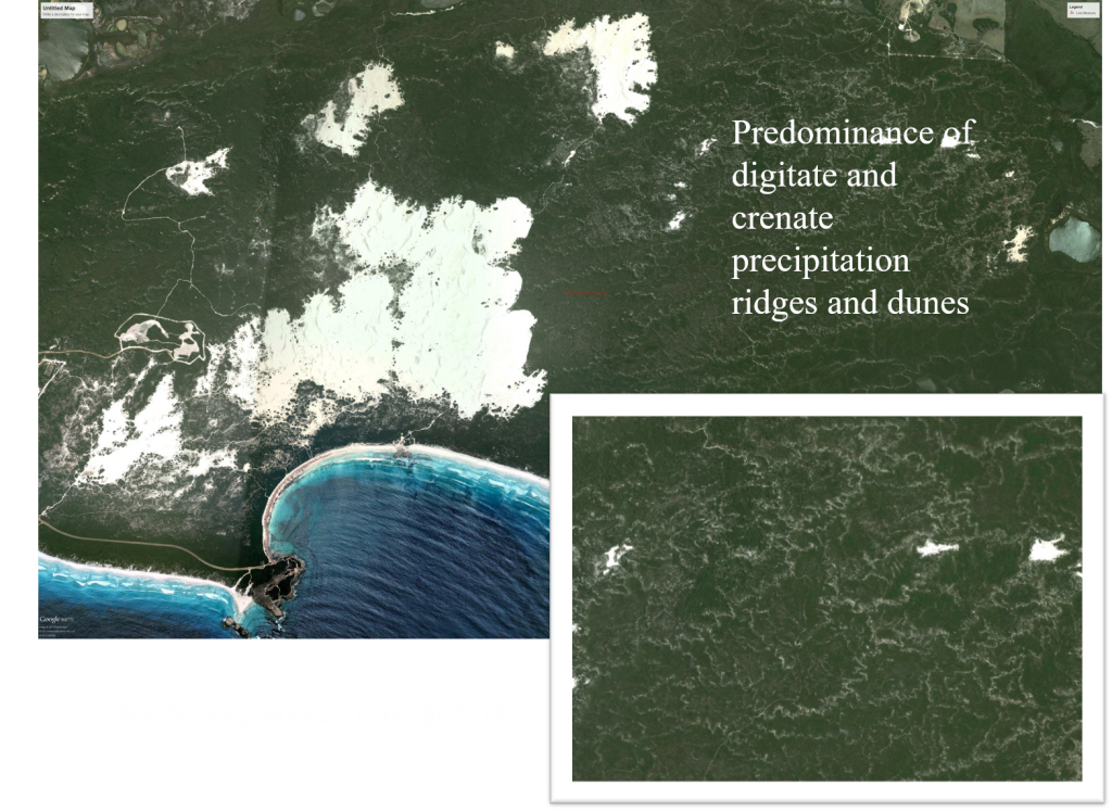
This project is generating fundamental information about the timing, formation and geomorphology of sand dune systems comprising the Cooloola sand mass and Fraser Island, Queensland.
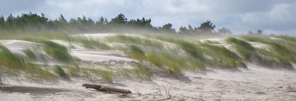
Foredune Dynamics of the Leba Barrier (Poland)
Aust$300,000 in 2019 from The National Science Centre in Poland for Airflow and aeolian sand transport dynamics beneath and above vegetation canopies – implication for foredunes initiation and growth, UMO-2018/31/B/ST10/03051. In collaboration with Maciej Dluzewski (University of Warsaw) and Joanna Rotnicka (Adam Mickiewicz University), this study aims to examine sand transport within, across, and over vegetated foredunes with variable percent plant cover, and especially try to better understand suspended grain flow above a plant canopy under a range of incident wind velocities.
Photo Credit: Joanna Rotnicki
For further information, please contact Professor Patrick Hesp @ patrick.hesp@flinders.edu.au.
Nebkha Dynamics and Geomorphology (Canary Islands)
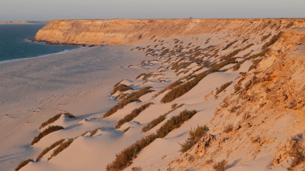
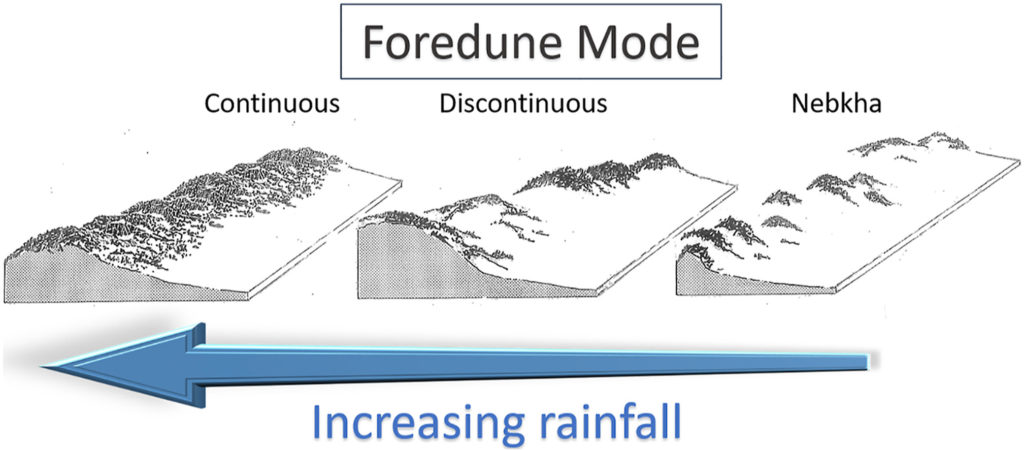
This research examines the role of climate in driving foredune and dunefield evolution and dynamics. Recent work on the South Australian Great Australian Bight coast, Morocco and Western Sahara coast, and the Canary Islands shows that foredune mode (continuous foredunes; discontinuous foredunes; nebkha) is strongly influenced by rainfall.
For further information, please contact Professor Patrick Hesp @ patrick.hesp@flinders.edu.au.
Megablowout Evolution (Tibetan Plateau, China)
More to come soon…
More Research Collaborations
We also have collaborations with these industry and academic partners both nationally and internationally:
National Collaborators:
– University of Western Australia
– University of Queensland
– University of Melbourne
South Australian Collaborators:
– Department for Environment and Water
– South Australian Research and Development Institute (SARDI)
– South Australia Environmental Protection Authority (SA EPA)
– SA Water
International Collaborators:
– ULPG (Canary Islands)
– Federal University of Rio Grande do Sul (UFRGS)
– University Guelph (Canada)
– US Fish and Wildlife Service (California)
– The Chinese Academy of Science
– Xi’An University
– Lanzhou University
– Sun-yat sen University
– University of Amsterdam (Netherlands)
– Polish Academy of Science
– University of Warsaw (Poland)
Other Recent Research Projects:
– Late Pleistocene and Holocene evolution of coastal barriers (e.g. Fraser Island, Younghusband Peninsula, southern Brazilian barriers),
– Impacts of climate and future climate change on dunefields,
– Computational fluid dynamics modelling on dunes,
– Sediment transport processes in Gulf St. Vincent,
– Drivers of South Australian coastal transgressive dunefield evolution,
– Nebkha evolution and dynamics,
– Arid coastal dune dynamics, and
– Foredune aerodynamics and sediment transport.
Past Research Projects:
– Relationships between surfzone fauna and surfzone dynamics,
– Holocene (past 10,000 years) evolution of coastal barriers,
– E.I.A. of coastal developments,
– Interrelationships between surfzone processes, regional winds and dune field evolution
– Evolution and aerodynamics of Earth and planetary dune systems,
– Coastal dune initiation,
– Nearshore and surfzone sediment transport,
– Coastal modelling and observations of waves and currents, and
– Aerodynamics and ecology of coastal dunes.
